The third Kirkwood Planning Advisory Committee meeting was held on Wednesday, July 16, 2014 at Kirkwood City Hall. The summary of the meeting and the agenda can be downloaded below:
If you have any questions or comments, please contact Marielle Brown at marielle@trailnet.org or 314.436.1324 x115.
Kirkwood Planning Advisory Committee Meeting 2 Summary and Documents
The second Kirkwood Planning Advisory Committee meeting was held on Monday, June 23, 2014 at Kirkwood City Hall. The summary of the meeting, along with the presentation and handouts can be downloaded below:
The planning team presented the Final Plan to the communities on the following days:
St. John City Council Meeting: 7:00 p.m. on Monday, July 7, 2014
Edmundson City Council Meeting: 7:00 p.m. on Thursday, July 10, 2014
Woodson Terrace Board of Aldmermen Meeting: 7:00 p.m. on Thursday, July 17, 2014
Overland City Council Workshop: 6:00 p.m. on Monday, July 21, 2014
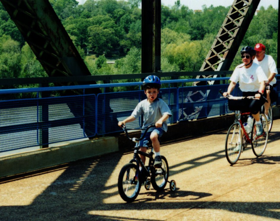
We pay for the roads, let’s join in how they are planned
When large road projects are built, we get a lot of people asking, “Why was the road built now? Why doesn’t it have sidewalks?” For large transportation projects, the answers can usually be traced back to the Long Range Plan produced by our metropolitan planning organization, East West Gateway Council of Governments. The Long Range Plan sets guiding principles for improving transportation in the region, along with creating a phased list of large-scale projects for the next 30 years. The plans are updated every five years, and the planning process for the next Long Range Plan is going on now.
Talking about transportation priorities in 30 year can seem abstract but the guiding principles in the Long Range Plan are the key to how approximately $40 million gets spent on transportation every year in our region. When your city or county wants to build and improve streets, intersections, sidewalks, and bicycle facilities, they often rely on transportation funds through East West Gateway. The projects are chosen using a scoring system based on the priorities in the Long Range Plan. The highest scoring projects end up in the Regional Transportation Plan (RTP), and are funded and built.
East West Gateway is working on a new Long Range Plan, so NOW is the time to speak up about your priorities for the region, and where you would like to see our money spent. East West Gateway is hosting a free speaker series at the Missouri History Museum that focuses on regional transportation issues with interactive audience polling. Click here for information and the dates for all four events.
The first event on June 18 at 7:00 pm is “Back to the Future: How St. Louis’ Transportation Past Informs our Future.” The speakers will look back at the history of transportation in St. Louis, which was founded before cars, streetcars, and even bicycles, to see what we can learn for the future. The speakers will be followed by a keypad polling session to gather public feedback on priorities.
This is a great opportunity to learn more about the history of St. Louis transportation, and make your voice heard about the future of transportation in St. Louis. In 2013, East West Gateway finished a three year, $4.6 million plan, OneSTL, to support sustainability in the region. We need to make sure the common-sense recommendations for sustainable transportation and funding are carried into the Long Range Plan. Trailnet will be at the meeting, advocating for improving and expanding sustainable transportation, including making transit, walking, and bicycling infrastructure a priority for the region.
We will also be focusing on financial sustainability. Every year, as we hear about bridges deteriorating and highways needing to be rebuilt, it is a reminder that our infrastructure does not last forever. We will be asking East West Gateway to help local governments build projects that they can afford to maintain and rebuild, when the time comes. All grant applications should include a financial plan for paying for regular maintenance on roads, along with reconstruction costs when the engineers estimate the road will need to be rebuilt, usually about 40 to 60 years.
By looking forward and anticipating our costs, we can make sure that we are building a resilient transportation system, and that we won’t burden our children with the cost of maintaining and rebuilding a transportation system we built without planning. We do this kind of long-term budgeting everyday in our own lives when we save for retirement, and in our businesses, when we set aside money to fix or replace equipment when needed. Let’s make sure our transportation budget fits the same standards. And if a local government can’t afford to replace a bridge once it can no longer support trucks, we can always look into giving the infrastructure to people walking and bicycling.
Old Chain of Rocks Bridge – formerly serving motor vehicles
Des Peres Walking and Bicycling Survey
Do you live, walk, or bike in Des Peres? Please help us create a plan that suits Des Peres by filling out a ten minute survey about walking and biking in Kirkwood. Your answers will guide the recommendations and priorities in the plan.
Through the end of July, the planning team will be at public events in Des Peres to gather input on walking and bicycling in the community, and find what residents value when it comes to transportation. The input will be used to guide the creation of a Des Peres Bicycle and Pedestrian Master Plan.
At these outreach events, you can talk to the planning team about walking and biking in Des Peres, what’s working, what isn’t, and how you would like to see walking and biking enhanced over the next 15 years. Outreach events will have maps, surveys, and comment cards to capture your thoughts and suggestions. The planning team will be available at the following events; please come out and talk to them about the future of walking and biking in Des Peres.
An online survey may be accessed here: https://www.surveymonkey.com/s/DesPeres; it is also available on paper at the Des Peres City Hall and at the tabling events
St. Louis is ready for low-stress bicycle and pedestrian connections. Low-stress connections, as seen below, provide safe, comfortable, and convenient walking and biking routes to popular destinations. Many cities in the U.S. are using low-stress connections because they spur economic development and attract high numbers of bicyclists and pedestrians. It’s time for St. Louis to build low-stress connections and enjoy all of the benefits.
This is a digital copy of the full 100-page guide. Click here to download.
Planning Advisory Committee Meeting #1
The first Planning Advisory Committee Meeting took place April 28, 2014 at the Kirkwood Recreation Center. The meeting focused on introducing the committee members to the planning process and gathering information on existing conditions.
Meeting Summary and Materials The draft summary of the meeting is available here.
The handouts and presentation from the meeting can also be downloaded:
Meeting Follow Up
At the meeting, committee members requested more information on walking and biking.
The following resources are available for committee members and all Kirkwood residents to better understand walking and biking:
Through the end of June, the planning team will be doing outreach in Kirkwood to gather input on walking and bicycling in the community, and find what residents value when it comes to transportation. The input will be used to guide the creation of a Kirkwood Pedestrian and Bicycle Master Plan.
At these outreach events, you can talk to the planning team about walking and biking in Kirkwood, what’s working, what isn’t, and how you would like to see walking and biking enhanced over the next 15 years. Outreach events will have maps, surveys, and comment cards to capture your thoughts and suggestions. The planning team will be available at the following events; please come out and talk to them about the future of walking and biking in Kirkwood!
Plan review will take place in the fall through a variety of public events; stay tuned for more details later in the summer
Kirkwood Walking and Bicycling Survey: Please share your thoughts with us
The survey is now closed. A summary of the survey results will be posted soon. Thank you for being involved!
Do you live, walk, or bike in Kirkwood? Please help us create a plan that suits Kirkwood by filling out a ten minute survey about walking and biking in Kirkwood. Your answers will guide the recommendations and priorities in the plan.
Be on the lookout for a second survey in your Kirkwood utility bill in April. The general survey will focus on community vision and values when it comes to transportation.